Farmlands: What 60 acres of Commercial development looks like in Alachua
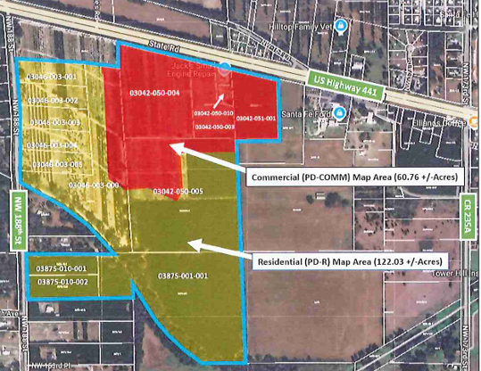
The Farmlands proposals requests a change to the City of Alachua’s Future Land Use Map to accommodate 60 acres of Commercial development that would then, if approved by the City Commission, correspond to the zoning districts seen in red and yellow.
This screenshot is public record, taken from a document titled ROADWAY SEGMENT LEVEL-OF-SERVICE ANALYSIS FARMLANDS MIXED USE ALACHUA, FL by Optimus Traffic Solutions prepared for Rise Partners submitted to the City of Alachua on October 30, 2025.
So what does 60 acres of commercial development look like around Alachua? Let’s visualize it using Google Earth.
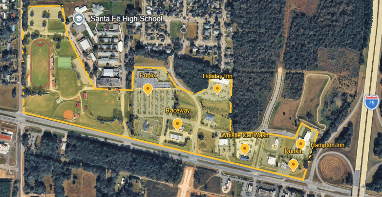
Here’s what 60 acres looks like on HWY 441 between 235a and I-75.
From East going West, this includes Dunkin Donuts and Hampton Inn to Whistle Car Wash, Holiday Inn, Publix, along the athletic fields and student parking lot at Santa Fe High School.
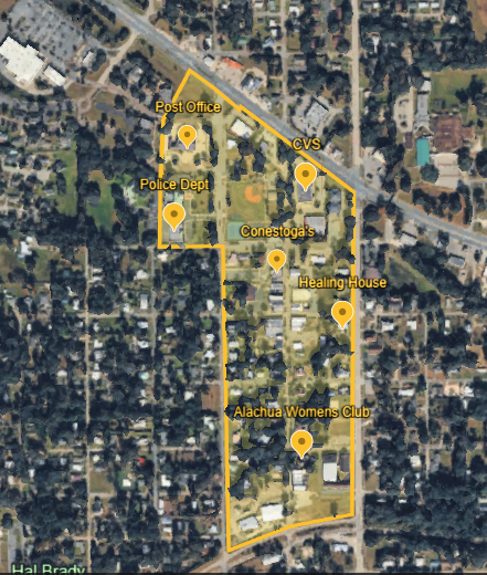
Here is what 60 acres look like in downtown Alachua.
Going North to South, the highlighted area here includes the Post Office and Police Department to CVS, then all of Main Street from HWY 441 to Peggy Road.
Everyone who loves to live in the Alachua/High Springs region is a stakeholder in this decision. If you are concerned about adding 60 acres of new commercial development on HWY 441 west of 235a, you can send a pre-written email from the Home page - just look for the green box.
To show up in person, this agenda item is expected to be deferred from the City of Alachua Commission meeting on May 4, 2026 to June 8, 2026.
Public comment is welcome at every City Commission meeting.